We use cookies to make your experience better. To comply with the new e-Privacy directive, we need to ask for your consent to set the cookies. Learn more.

* Watermarks are removed from finished murals.
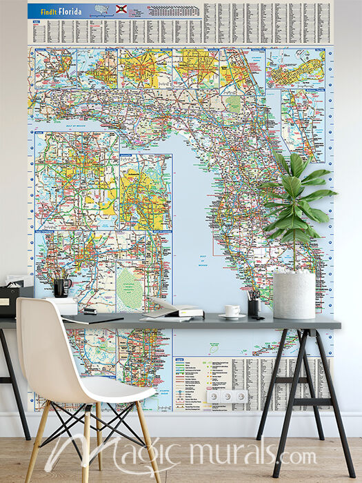
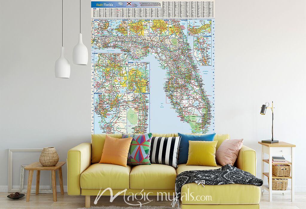
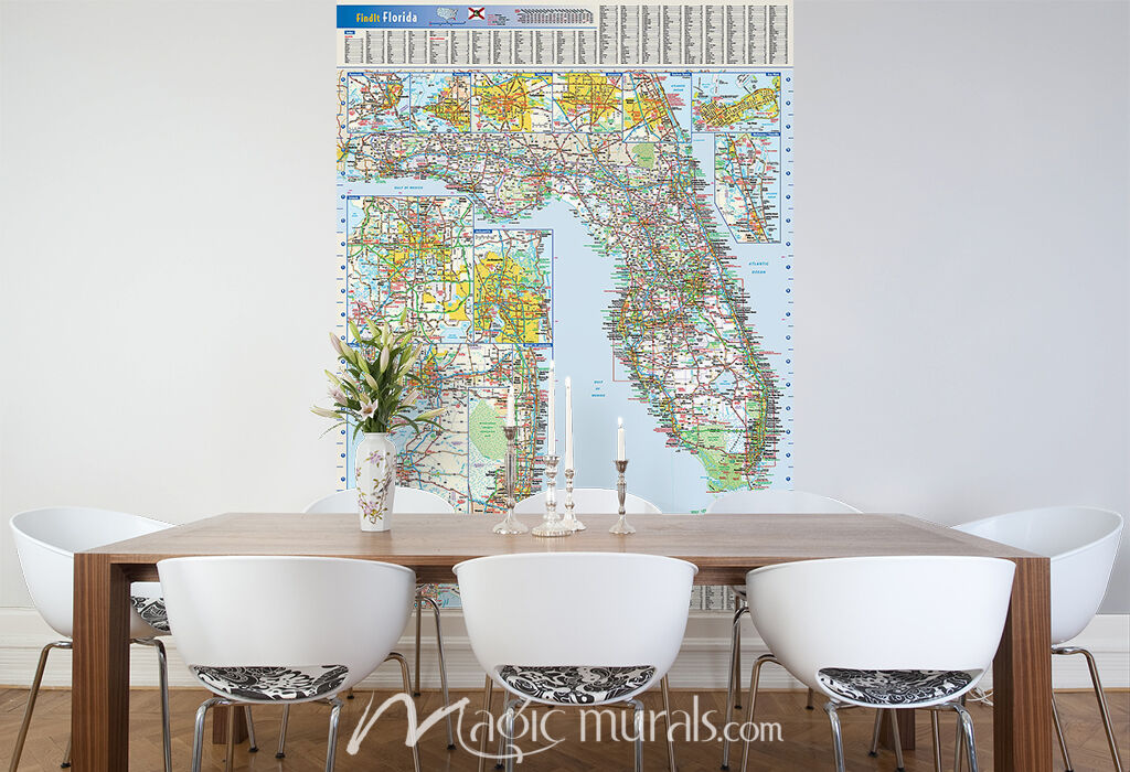
Florida State Map
Special Price $69.72 Regular Price $93.00
25% OFF
Mural ID:
GLO-0000000020
This colorful, easy-to-read state map of Florida identifies all major highways and secondary roads, points of interest, recreation areas, and more. Shaded relief on the state map provides a three-dimensional sense of Florida's topography. Detailed city inset maps of Daytona Beach, Gainesville, Jacksonville, Key West, Melbourne/Titusville, Miami/Fort Lauderdale, Orlando, Panama City, Pensacola, Tallahassee, and Tampa/St. Petersburg are based on the latest information from GeoNova's cartographic experts. An inset of downtown Miami provides detailed information of the central business district. County and city indices make it simple to locate even the smallest town. © 2013 Globe Turner

- We Make Better Murals!
- Amazing Customer Service!
- Quick Delivery!
- Free Ground Shipping in the Continental U.S.!
At Magic Murals, our goal is to exceed your expectations with every mural you order from us. All Magic Murals are custom printed and inspected by our staff before being packaged for delivery. We take pride to ensure that your mural is in excellent condition before leaving our facility. Our wall murals are the highest quality available, and we stand behind our products. Not only do we want you to be completely satisfied with the quality of your new mural but also the level of service that you receive from us. If you have any questions or experience a problem with your order we want to know about it. Our knowledgeable and friendly team is ready to assist you.
If you receive an order and you are not 100% satisfied with the quality of your mural, feel free to e-mail us directly at help@magicmurals.com or contact us by phone at 1-877-448-7295 Monday - Friday, 9:00 am to 5:30 pm EST. We recommend that you first review our return policy for further information to familiarize yourself with the return process before contacting us.
We appreciate the opportunity to serve you!
Metric Calculator
Enter US dimensions for Metric conversions or enter Metric dimensions for US conversions.
Use the Reset button to start over.
Metric Converter
Enter Metric dimensions below which will convert and populate US dimensions in the Custom Size fields.
Verify Crop
*Watermarks are removed from finished murals.
Click "Add to Cart" if you accept this crop indicated by the red outline.